The photo was originally posted here, where present-day landmarks are pointed out. You can also download a full-sized photo there. A comment on the Marmot's post reveals that the photo is captioned as follows:
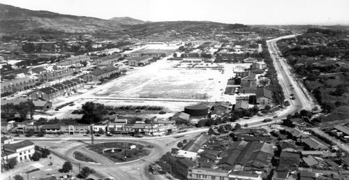
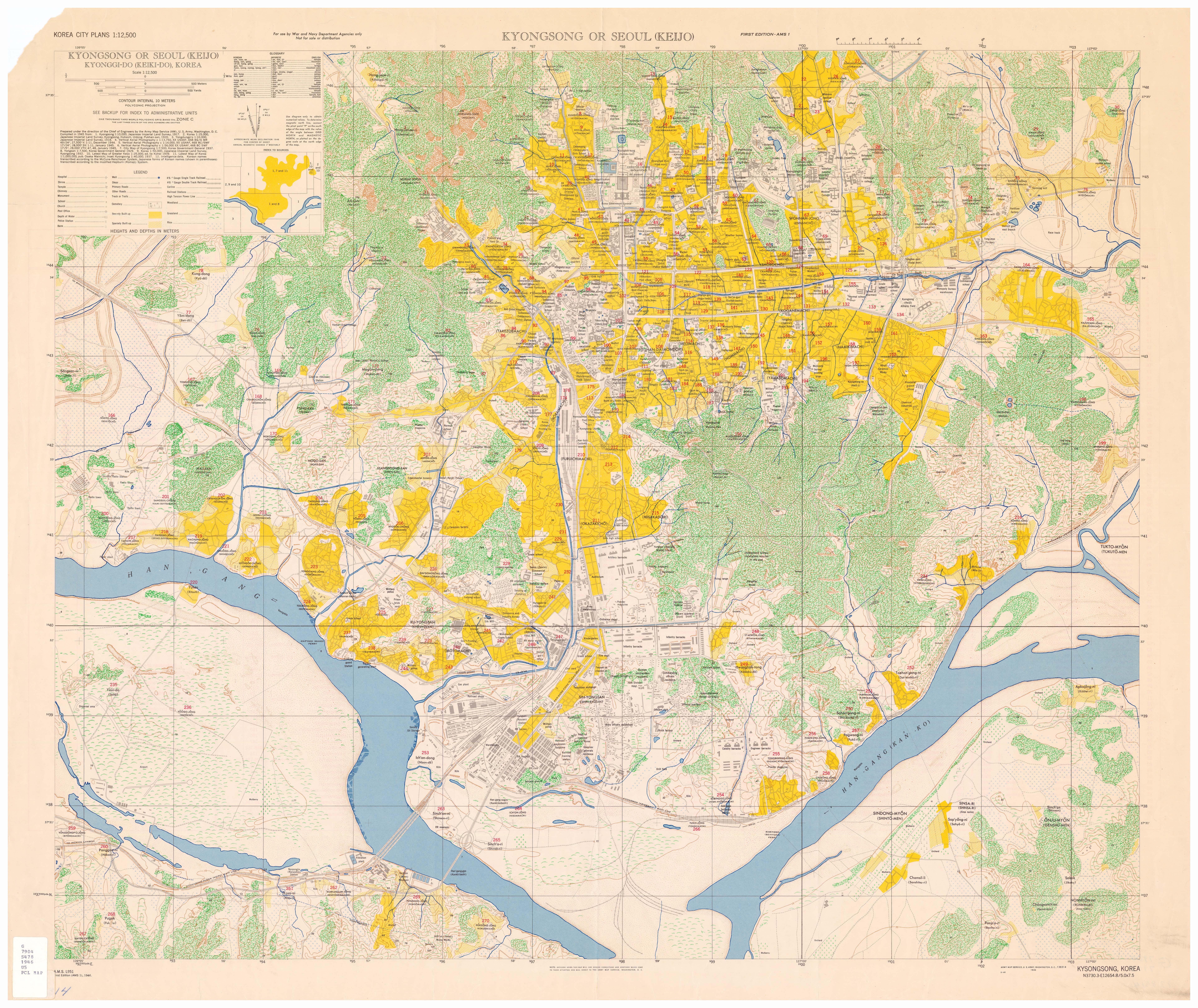
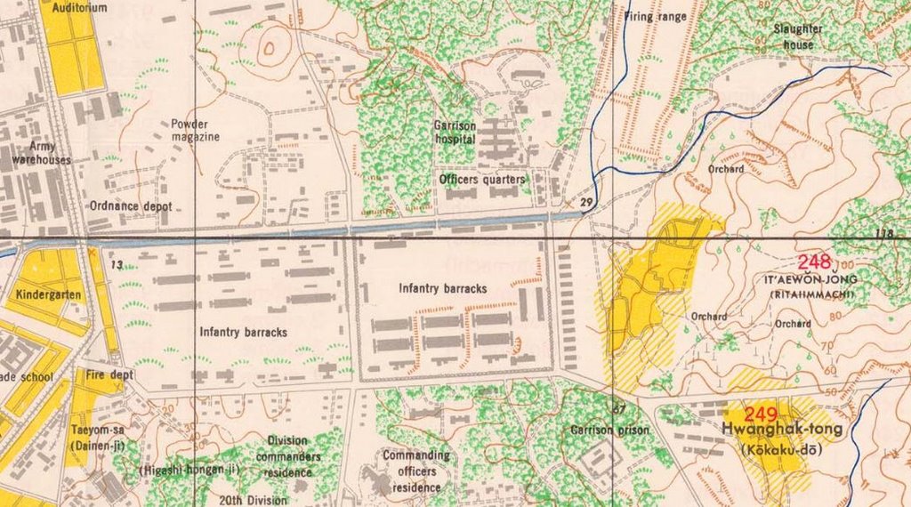
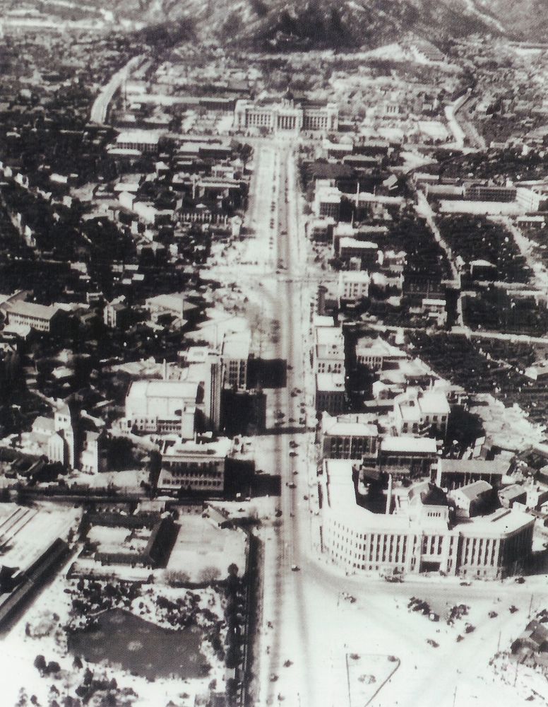
Photo by US Army - 24 September 1948At the time the US occupied Seoul after liberation (when they took over the former Japanese barracks at Yongsan which are pictured above), the U.S. Army Map Service made a map titled "Kyongsong or Seoul (Keijo) Kyonggi-do (Keiki-do), Korea" (original scale 1:12,500) in 1946. It can be found in full here. Pictured below is the part of the map which describes the landscape in the photo above; as the photo is facing east, the foreground of the photo can be seen at the left of this map, and the background is at the map's right:
HQ, 7th US Infantry Division, 31st and 32nd Infantry Regiments
Samgak-Ji, Yongsan, Seoul
My attention was drawn back to this photo after the Metropolitician linked to it and came up with a theory as to how the photo was taken:
More likely is this picture perhaps being shot from a plane window [...] I know that Yeouido was a landing strip for US planes for a long time, but not sure if 1) this picture was indeed taken in the late 1940's, and 2) if it was, when the US airstrip in Yeouido appeared. Still, it seems like this shot would make sense if a soldier snapped a shot while on approach for a landing in Yeoiudo. The picture seems like it was taken from around the right altitude, from my experience as a civilian plane traveler. If I were on approach to land in Yeouido, it seems like this would be a very possible snapshot to take.Well, the comments upon the Marmot's post revealed that the picture was indeed taken in 1948. At that time, many aerial photos of Seoul (and elsewhere in Korea) were taken by the US military, such as this one of downtown Seoul:
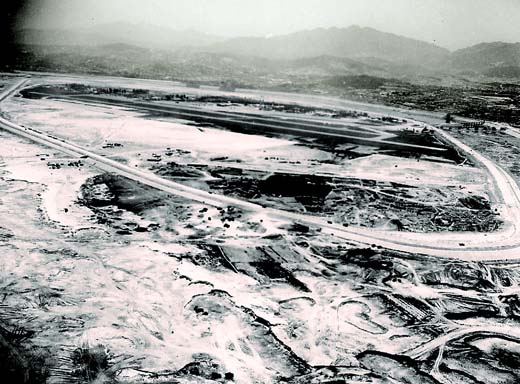
As for Yeouido Airport, it was not built by the US, but by the Japanese. According to this site, in 1916 a rough surface air strip was built on Yeouido, and it became an official airport in 1924, serving international, domestic, and military flights. It was also the site of a flight school. After 1948 it became a civilian airport. I managed to find this photo of the airport from the 1930s:

Here's a photo of composer An Ik-tae leaving the airport in 1955 (perhaps those are the same buildings in the distance?)

Yeouido Airport was turned over to the military in 1958, when Gimpo became the new international passenger airport (Gimpo had been built between 1939 and 1942 by the Japanese). In the late 1960s the decision was made to develop Yeouido. In 1967 construction began on embankments to protect the island from the flooding that had always made it useless land (Yeouido means "You can have it").
 Yeouido, looking north, 1967
By 1968, the walls were completed, leading to this photo, which looks south-east:
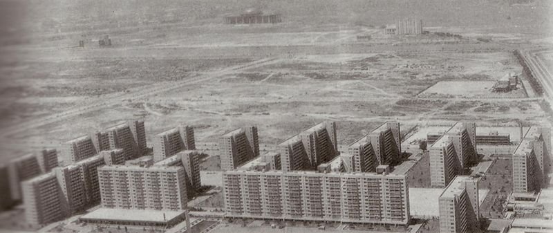
To complete this historical footnote, in 1971, the Sibum apartments, Korea's first high-rise apartment complex, was completed, and the all important 5.16 plaza was built in front of the National assembly (to commemorate Park Chung-hee's May 16, 1961 coup, of course). This square was turned into a park in 1999. As this photo shows, the outer shell of the new national assembly (which wouldn't open until 1975) seemed to be completed at the time of the Sibum apartments' construction.
 Looking west from the current location of the 63 building
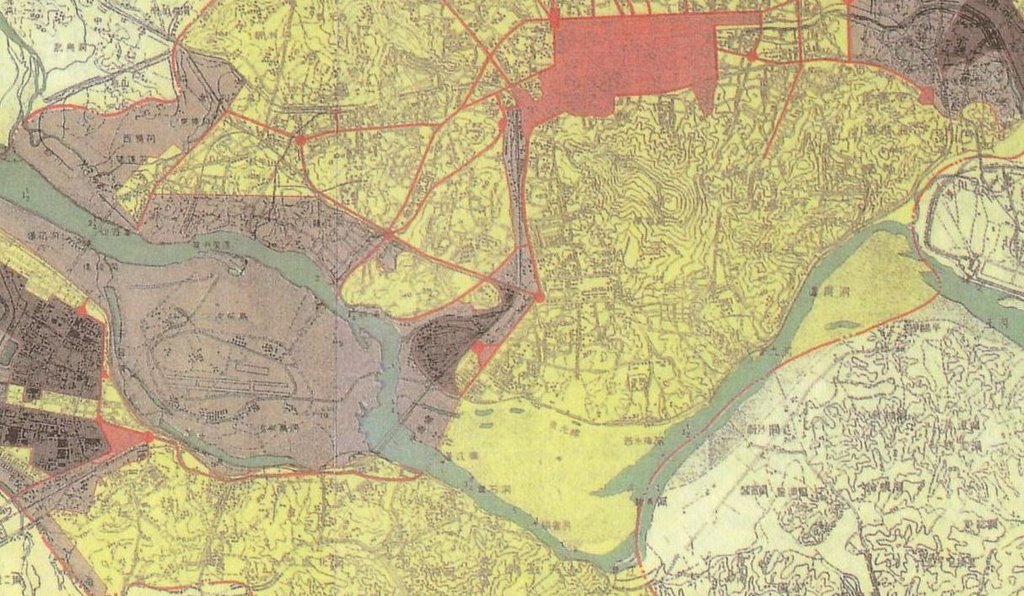
Now, if we look at the runway visible in the two photos above (which were taken from this Hankyoreh article), we can see that the runway is running across the island from east to west (or vice versa). This 1939 map, which shows the runway, makes it a bit clearer:
Now, the Metropolitician wondered if the photo of the Yongsan barracks was taken from a plane about to land at Yeouido airport. Perhaps if he had read this article about Gimpo airport by Andrei Lankov, he might have been confused (as I was, until I found these photos), because of this description:
At the time, the nascent Korean civil aviation used Yoido airfield, located on the spot now occupied by Yoido Park, (its unusual, elongated shape still betrays its origin as an air strip).Yeouido park actually runs from north to south, so it can't possibly occupy the spot of the airstrip, which ran from east to west. If you look closely at the map, the red dot in the very middle would be the Samgakji Rotary; the plane would have likely been flying in a north to south direction (or vice versa, but let's assume north to south if it was landing). It would therefore be necessary to turn close to 90 degrees after taking the picture - at a spot that is only 3 or 4 kilometers from Yeouido's runway. The low-flying plane from which the photo was taken would have been quite a bit smaller than those of today, but would it have been normal protocol to make such a turn so close to the runway? I really don't have a clue about such things; perhaps someone can comment on this. I'm quite certain the photo was taken from a plane, and a low flying one at that, but due to the location and direction of the runway, I have my doubts that it was taken while landing.
No comments:
Post a Comment